BUNKERS at Guantanamo Bay, Cuba

A bunker is typically part of a military fortification and can mostly be found on coastal fortifications. Guantanamo Bay has several styles of bunkers that were built during World War II and the Cold War.

World War II Bunkers

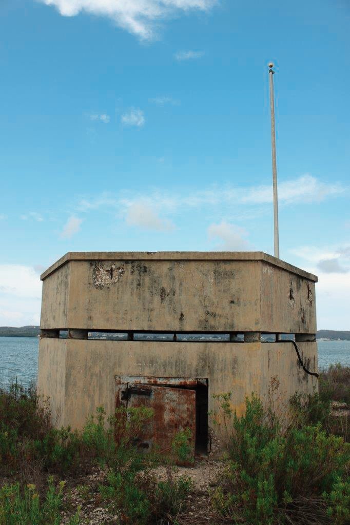
World War II Bunker at Facility 549 at Guantanamo Bay built in 1942 (A. Thomas).

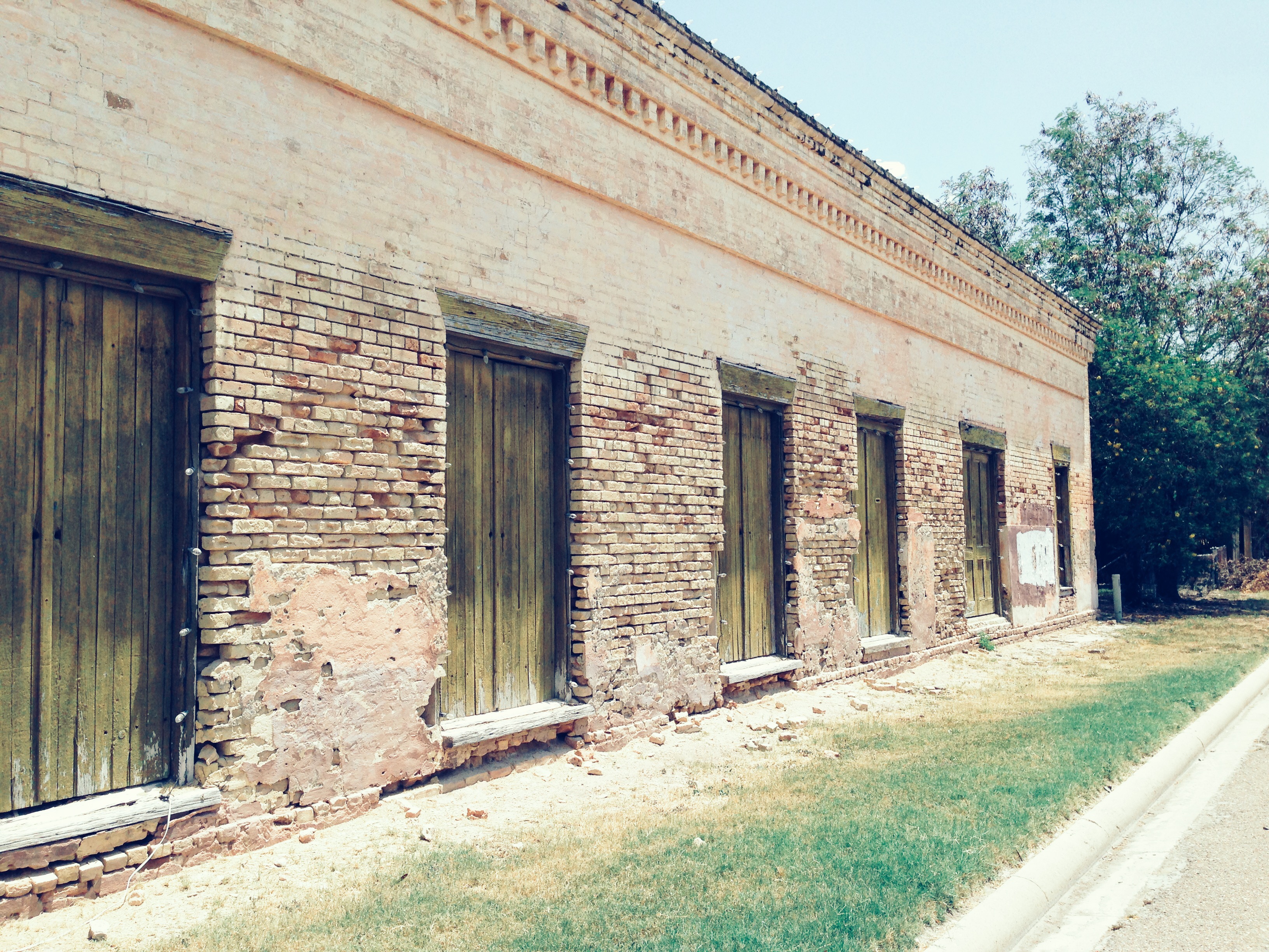
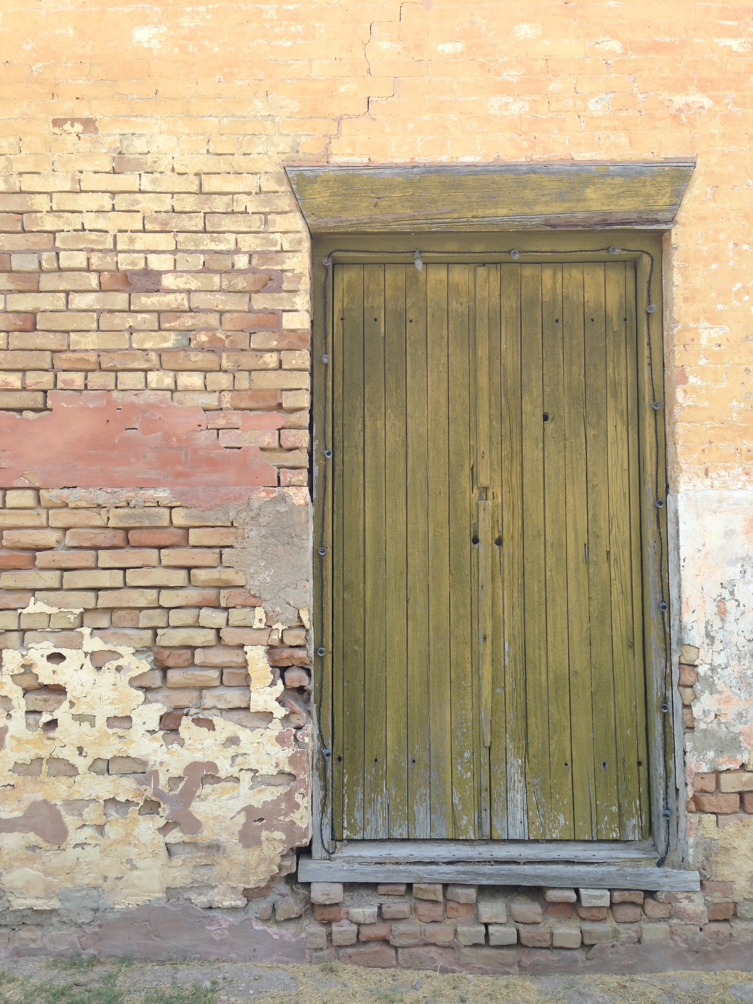
Bunkers built during World War II were typically built using hexagonal (six-sided) plan. Structural features include a flat roof with a slight drip edge, board-formed poured-concrete walls and roof, a small steel-door entrance, and a narrow horizontal viewing window (roughly six inches wide) that encircles the entire structure. The viewing window gave occupants an unimpeded view of the entire bay.

World War II bunker located on Hospital Kay at Guantanamo Bay, Cuba (A.Thomas).

Cold War Bunkers

A 2003 update to Rear Admiral Murphy’s 1953 History of Guantanamo Bay discusses the Cuban Missile Crisis of 1962.  In June of 1962, Mobile Construction Battalion Four, or “Seabees,” was deployed to Guantanamo Bay for training. When the Missile Crisis started in October, the Battalion was still at Guantanamo Bay and was put to work upgrading the base’s defenses. The Seabees, with some assistance, built over 20 miles of new roadways during the first two weeks of the crisis. They also built hundreds of reinforced-concrete bunkers throughout Guantanamo Bay.

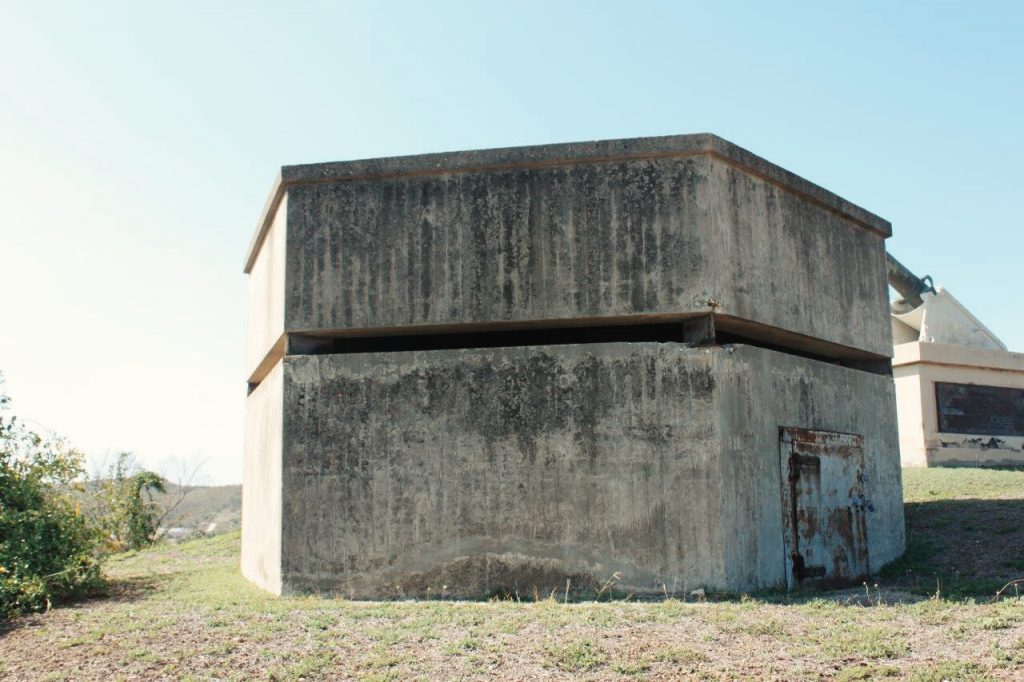
Bunker No. 1 (A. Thomas).

Bunker No. 1 is constructed using Concrete Masonry Unit (CMU) construction with a flat steel roof. The building is set into the hillside, so that half of the building is underground. The building has openings on each side so that the view is unobstructed.

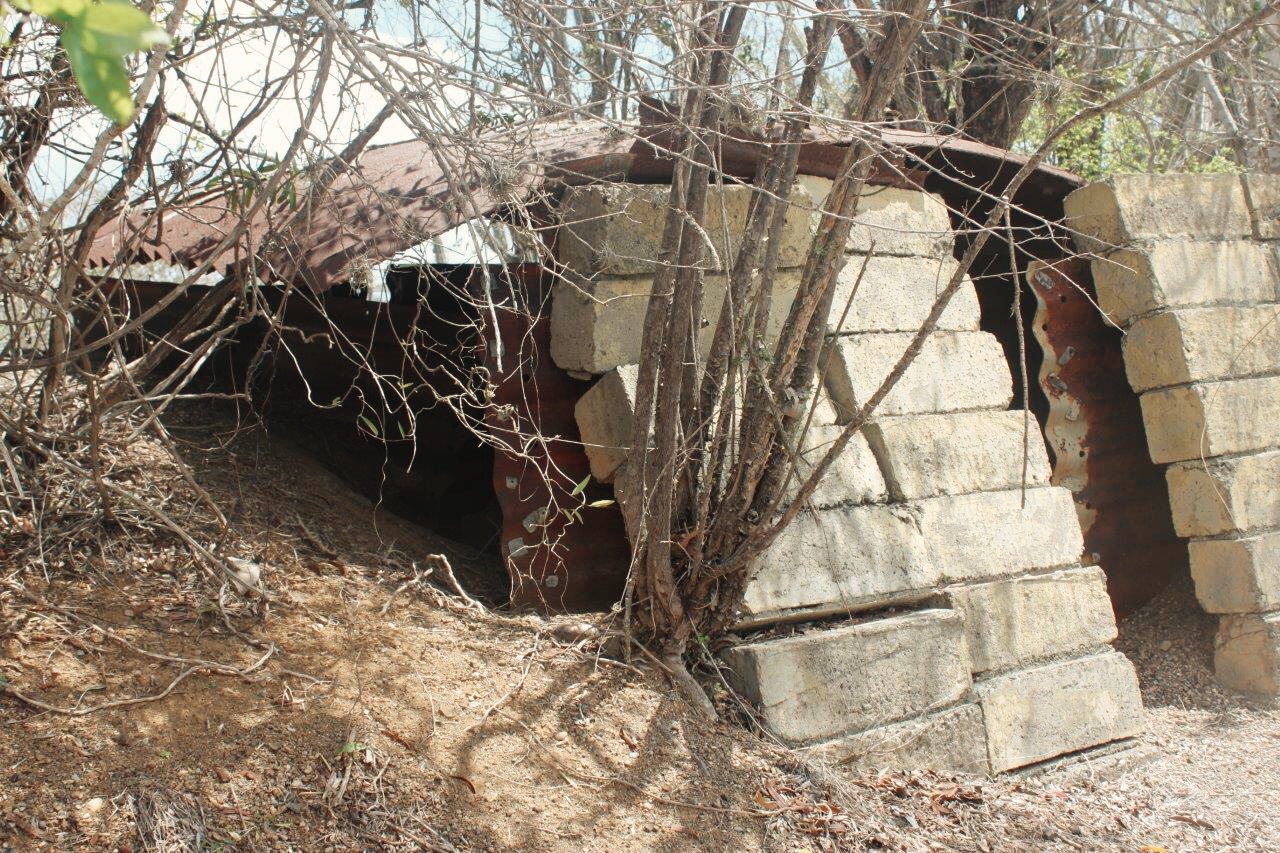
Bunker No. 2 (A. Thomas).

Bunker No. 2 has an arched corrugated metal roof and CMU walls.  The building is set into the hillside, so that half of the building is underground.  The facade set into the ground has a view of the bay. Opposite that is an open doorway.

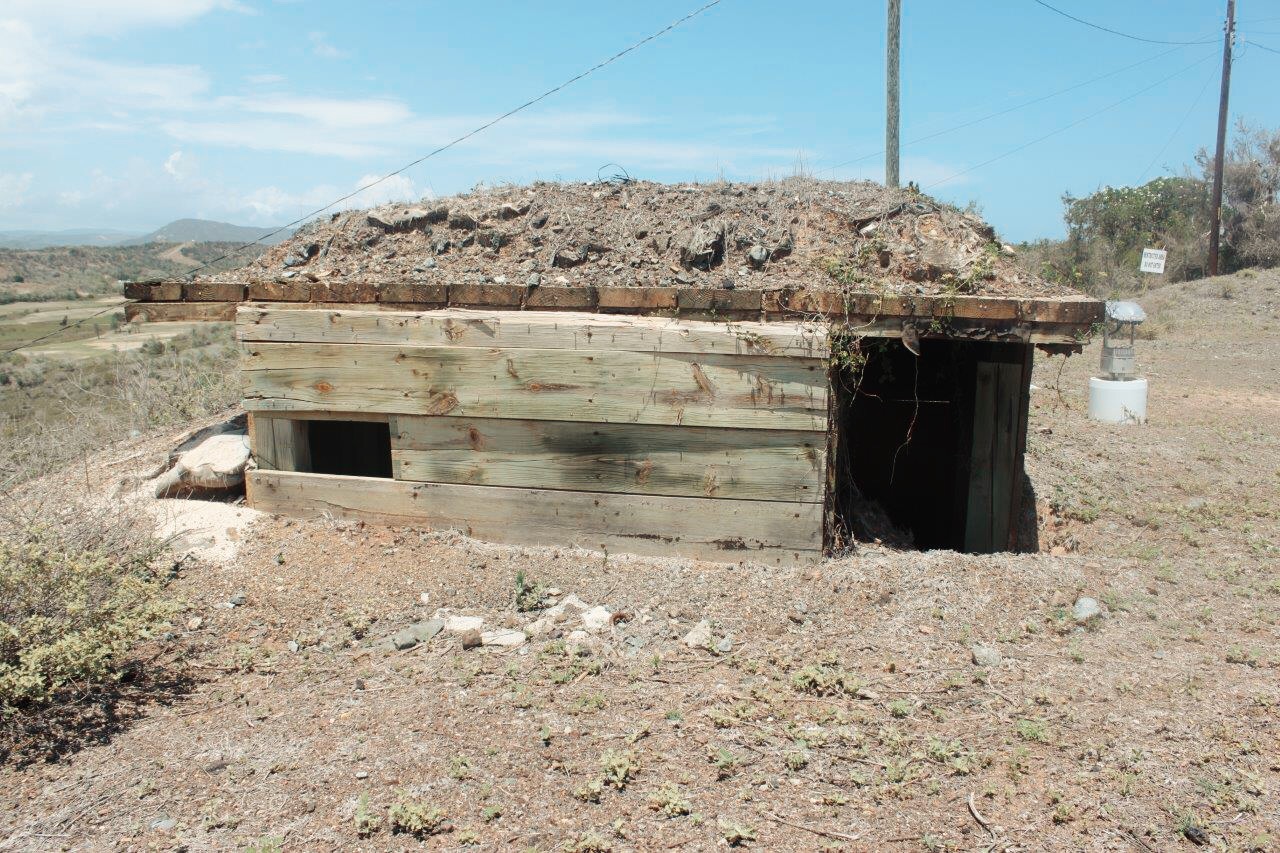
Bunker No. 3 (A.Thomas).

Bunker No. 3, when in use, concealed vehicles or large artillery. It is constructed with large boards for the roof and sides. The earth has been built up around three sides of the structure with sand bags and then covered with brush, likely to camouflage the structure with the surrounding landscape.

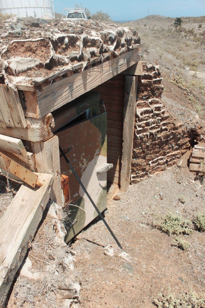
Bunker No. 4 at Guantanamo Bay (A.Thomas).

Bunker No. 4 is constructed using large boards for the roof and sides. The roof has been covered using sand and brush, likely to camouflage the structure with the surrounding landscape. The building is set partially underground, similar to other bunkers of this era. There are openings on one side to give occupants an unobstructed view.

Hidalgo Viego Historic District

Former Post Office of Hidalgo, Texas (1839) (A. Thomas).

The Hidalgo Viego Historic District, or Old Hidalgo, is located in Hidalgo, Texas. The district consists of six buildings from the late 19th century and include the Old Hidalgo County Courthouse and jail (1886), Post Office (1839), the Rodriguez Store (1890), the Odell Store (1889), and the Rodriguez Pioneer House.

Handmade bricks from Reynosa, Mexico (A. Thomas).

The former Post Office is constructed with handmade, fired bricks from the brickmason Juan Rios in Reynolsa, Mexico. The building appears to have a flat roof with a continuous parapet and a brick entablature with decorative brick dentils. The walls are done in the English bond system with alternating of headers to every five stretchers. The other five buildings were constructed in a similar fashion, likely using the same handmade bricks.

Weathering and decay have caused voids between the brick units (A. Thomas).


Lighthouse at Guantanamo Bay, Cuba


Photos by Alexis Thomas.

The south elevation. The Keeper’s cottage can be seen in the background (A. Thomas).

The weather vane bears an “N” for north, an “S” for south, an “E” for east, and an “O” for oeste (the Spanish word for “west”) (A.Thomas).

The lighthouse at Guantanamo Bay, Cuba is labeled as Facility 831.

Built on a circular plan, the cast-iron lighthouse was constructed in 1903. The tower is 60 feet tall. The original lamps were whale oil lamps that were used until the 1920s when they were replaced by electric lights.  In the mid-1960s the lens, prisms, and the mechanism for making the light revolve were removed and put on display at the U.S. Coast Guard Academy in New London, Connecticut. Structural features are steel panels and six steel support braces, window bays with steel security bars, steel louvered storm shutters, a molded copper cupola and weather vane, and a tongue-and-groove mahogany interior. The lighthouse is five stories and has a steel frame. According to base historians at Guantanamo Bay, the  lighthouse was constructed in New York and shipped in parts to the island.

The roof is a molded copper cupola and  with a copper weather vane. The cupola is molded copper, as is the weather vane. The weather vane bears an “N” for north, an “S” for south, an “E” for east, and an “O” for oeste (the Spanish word for “west”). The windows are steel security bars and steel louvered shutters.  The only door is steel, as is the walkway. There is a significant amount of deterioration in the form of rust and structural damage on all elevations, as well as the walkway and its railing.

According to the U.S. Coast Guard, the use of cast iron in lighthouse construction began in the late 1830s or early 1840s. The perceived advantages were that it was light compared to brick or stone, inexpensive, strong, water tight, and had a slow rate of deterioration. They were more adaptable to coastal areas where a relatively light pile structure was required due to mud, sand, swamp, or coral. Another example of cast-iron lighthouses is Brandywine Shoals off the coast of Delaware.

The walkway shows significant deterioration. All window bays have steel safety bars and steel shutters (A. Thomas).

Steel door at the base of the lighthouse on the south elevation (A. Thomas).

Fort Livingston

Fort Livingston is located on the western end of Grand Terre, facing Barataria Pass. At the outbreak of the Civil War, the fort had no weapons or troops. Confederate troops took it over in early 1861, possibly January or March. By July of that year, Confederate General David Twiggs indicated that the fort was manned by two companies of volunteers. In December of that year, 400 men manned one 32-pound rifled artillery piece, one 8-inch Columbiad, seven 24-pound howitzers, and four 12-pound howitzers.

Ariel view of Fort Livingston on Grand Terre (National Park Service).

Plans for Fort Livingston were prepared in Washington by Lieutenant H.G. Wright under the direction of Chief Engineer Colonel Joseph Gilbert Totten in 1841-42. The original design of the fort was a trapezium-shaped stronghold, surrounded by a wet ditch, and outworks on the land side. The walls were constructed of cemented shell faced with brick and granite trim. On top of the ramparts is the terreplain were cannons were mounted.  The terreplain was fronted by a parapet, only a portion of which remains. Inside the ramparts, barrel vaulted chambers, or casemates, surround the court with viewholes for guns facing outward and doors with granite lintels opening to the courtyard. The original plans indicate that inside the casement were to be the soldiers’ quarters, officers’ guard room, guard room, prison, sutler’s room, artillery store room, magazine, carpenter shop, blacksmith’s shop with a forge, and a bakery with an oven.  Exterior granite stairs were indicated to be on two sides of the court. What was probably a long ramp, which would have ascended the south wall, is also show on the original plans. In 1849 Captain J.G. Barnard, superintending engineer, prepared a sketch of a “piazza” to line the walls of the fort facing the courtyard. It consisted of slender iron columns with foliated capitals supporting an arched arcade with a tiled shed roof. If this “piazza” was ever constructed, there are no remnants of it today.

View of the south elevation of Fort Livingston (National Park Service).

The fort was protected on the land side by a moat or wet ditch and a counterscarp, or outer wall, which was supported by arched and counter-arched revetments to strengthen the wall against bombardment. For additional protection, the outer wall was faced with a sloping earth glacis. Within the outerwork wall is a long tunnel-like covered way, or patrol path, called the counterscarp gallery, that provided protected exterior access along the complete distance of the land faces of the fort.  Embrasures for small arms fire open form the interior passage way to the wet ditch. Powder magazines were also located in the counterscarp gallery. A drawbridge was designed to cross the moat from the top of the outer wall to the entrance on the north side of the fort. Having been constructed of wood, there are no remains of this bridge today.

Part of the what would have been the south elevation of Fort Livingston (National Park Service).

The south face of the fort, fronting the gulf was completely demolished by the hurricane of 1915 and sand dunes now fill the court and casemates.

Ariel view of Fort Livingston facing east (National Park Service).

Fort Livingston is one of the largest coastal forts in Louisiana and is Louisiana’s only fort on the Gulf of Mexico. Excepting Fort Point in San Francisco, Fort Livingston is the western-most of the system of coastal defenses that line the east and Gulf coasts of the United States.

Ruin of the counterscarp gallery. A counterscarp gallery are tunnels that are built behind the counterscarp, or the outer wall of the fortification (National Park Service).

Fort Livingston was abandoned after the Civil War and although the War Department had interest in the fort and the Board of Engineers in Washington proposed modifications for the structure in 1870, it was returned the State of Louisiana in 1923.

Interior of a casement of Fort Livingston (National Park Service).

Facing south towards the Gulf of Mexico, showing court facade of ramparts and doors with granite lintels. The doorways lead to casements (National Park Service).

Detail of the construction of Fort Livingston showing clam shells faced with brick (National Park Service).

More information:

NCPTT Field Report of Fort Livingston

National Park Service